

LAPAN-Tubsat and the beginning of Indonesia’s journey into satellite making
Did you know that Indonesia can actually build its own satellite?
It all began in 2003, when engineers from LAPAN (now BRIN ORPA) and the Chair of Space Technology at TU Berlin working together to create something Indonesia had never made before: A satellite that would fly in space.
Piece by piece, subsystem by subsystem, they began assembling: a satellite that could survive launch, communicate with Earth, and orbit the planet.
Four years later, on 10 January 2007, that dream finally rose off the ground—straight into orbit 630 kilometers above Earth. A microsatellite, carefully built through years of learning and collaboration, hitched a ride on India’s PSLV-C07 rocket and blasted off from the Sriharikota launch site in India. In that moment, Indonesia didnt just send a machine into orbit; it sent a message: “we can do this”
From circuits and code to orbit and signal—LAPAN-Tubsat turned engineering into reality
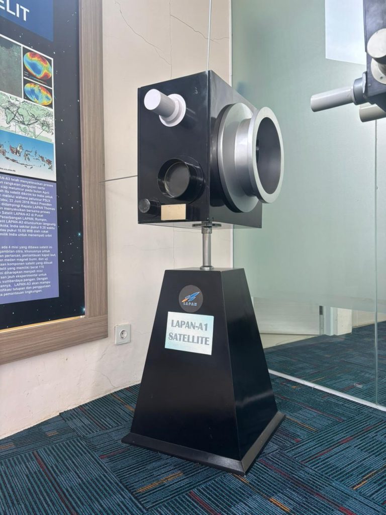
Let’s open it up a bit-
at first glance, LAPAN-TUBSAT might look like just a simple box. But inside, it’s carefully organized. The satellite is split into two main sections: upper shelf and lower shelf
In the lower shelf, you will find:
- ACS (Attitude Control System) : the satellite’s sense of direction, to know where its pointing
- TTC (Telemetry, Tracking and Command) : how satellite communicate with the ground stations
- Camera payload : its ‘eyes’ to capture the Earth
- Sband : to send data (like images) to the ground
In the Upper Shelf, you will find:
- Battery : stores the energy so the satellites keeps running even in eclipse
- Power control : distribute energy to every component
- PCDH (Power Control and Data Handling): basically, the satellite’s brain
- Air coil : a device that interact with earth magnetic field to control the satellite orientation
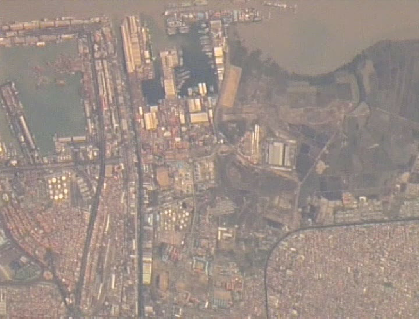
And what did this satellite actually see up there?
One of its early image results was the LAPAN-Tubsat capture of the shipyard in Surabaya, taken in 2008—a clear, detailed look structures from 630 km above Earth.
Hardhienata, Soewarto & Triharjanto, Robertus & Mukhayadi, M.. (2011). Presented at the 18th Asia-Pacific Regional Space Agency Forum LAPAN-A2 : Indonesian Near-Equatorial Surveilance Satellite.
Even earlier, in 2007, the satellite recorded video image over Singapore.
These images and videos became more than data. They became evidence. Proof that Indonesia’s first microsatellite wasn’t just flying— it was working, observing, and sending home valuable information from orbit.
References:
[1] Triharjanto, R. H., W. Hasbi, A. Widipaminto, Moh Mukhayadi, and U. Renner. “LAPAN-TUBSAT: Micro-satellite platform for surveillance & remote sensing.” In Proceedings of the 4S symposium: small satellites, systems and services (ESA SP-571), pp. 20-24. 2004.
[2] Hardhienata, Soewarto & Triharjanto, Robertus & Mukhayadi, M.. (2011). Presented at the 18th Asia-Pacific Regional Space Agency Forum LAPAN-A2 : Indonesian Near-Equatorial Surveilance Satellite.
[3] Richter, Wolfgang. “30 Years of Space Adventure.” Technische Universität Berlin, https://www.tu.berlin/en/news/reports/30-years-of-space-adventure.
Leave a Reply